

Map Distance app for iPhone and iPad
Developer: Pau Corbella
First release : 14 Dec 2010
App size: 780.21 Kb
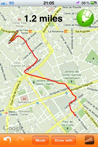
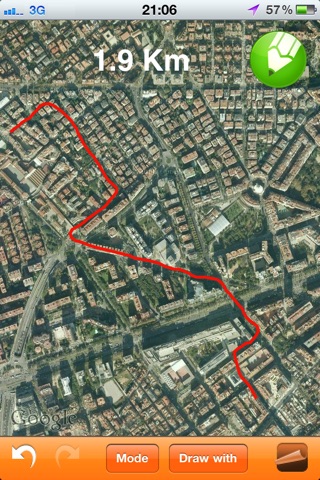
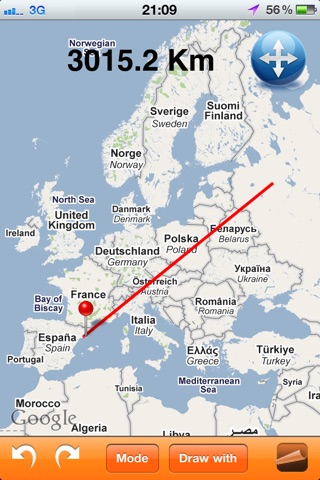
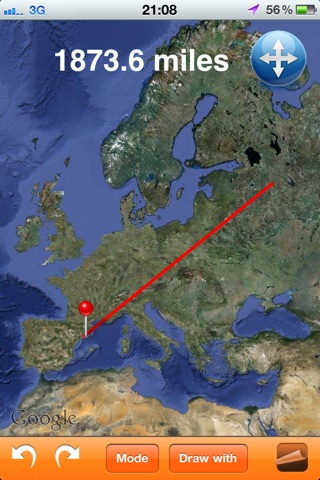
"Map Distance" allows users to know the distance of any path/route drawn on the map. Can be used in any zoom level, at any orientation (LANDSCAPE and PORTRAIT), being useful to calculate distances between countries, cities, streets as well as length of trails or routes. The feature of marking your current location allows also knowing any distance between you and other places.
Just drag your finger on the map and see in real time the overall distance! Can use straight lines to know point-to-point distance or curved lines to draw exactly the path you want to know the length. The path can have as many segments/stretches as you want, allowing to UNDO and REDO if necessary.
Once the path is drawn, it can be shared with others:
- by sending a ScreenShot of the map, or
- by sending a KML file which allows you to see the path in your computer with GoogleEarth!
The distance can be shown in international units (Meters/Km) or American units (Feet/Miles/Yards). The application can be used in either Map-Mode or Satellite-Mode.
This application is available in iPhone/iPod and iPad
For any trouble: [email protected]